Home - Union City Housing Element Adopted January 27, 2015
Union City Housing Element Adopted January 27, 2015
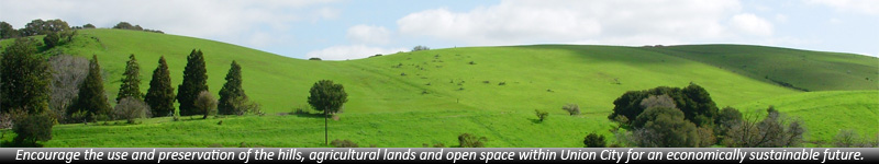
The housing element of the General Plan bases its housing needs on the Association of Bay Area Governments (ABAG) housing projections for new construction and Council approved this plan in January 2015 ahead of the 2040 General Plan Update. This housing plan needs to change by a majority of City Council votes NOW in order to save Open Space, Ramirez Farm, Historic farmhouse and Alameda Creek to make up our 77-acre parkland deficit. Public land has the greatest potential for parks and open space as the City can purchase this land before private developers purchase this for housing.
Union City Housing Element (Click to view document)
See Figure 5-10 page 97 of 211
This figure shows 10.4 acres of open Space is located near channelized Alameda Creek at Paseo Padre Parkway and historic Alameda Creek that connects to the historic farmhouse. This open space is on Water District Property- public land. This land is planned to accommodate high-density housing of 89 units and 7 acres of open space as part of the 2040 plan.
The new proposal for Highway 84 is not shown but planned through the designated open space.
See Figure 5-13 page 97 of 211
This figure shows 37.5 acres of open space, Ramirez farmland, historic farmhouse and Alameda Creek bounded within Alvarado Niles Road, Quarry Lakes and Osprey Drive. This land is on Caltrans property - public land. This land is planned to accommodate high-density housing including 17 to 30 units per acre totaling 201 housing units plus will also accommodate a private institution (a not for profit entity that pays no property taxes). This land is planned for a new highway and does not include keeping the Ramirez farm, Alameda Creek, historic farmhouse and horse ranch.
The new proposal for Highway 84 is not being shown but would be located on the designated open space.